Autonomous platforms are able to collect an array of spatially and temporally explicit, multi-sensor data, including vast image-based datasets, offering either high or large spatial and temporal resolution. However, whilst use of these platforms, and their ability to make concurrent visual and environmental observation have already transformed our understanding of marine ecosystems – particularly hard substrate systems like reefs – the full potential of these autonomous systems has not yet been realised.
One of the greatest challenges to realising that potential lies in overcoming the bottleneck created by the need for manual (human) interpretation of seafloor image data to extract quantitative biological data.
Recent developments in artificial intelligence and computer vision have offered a potential mechanism to overcome that bottleneck, offering a faster, more consistent, cost effective and shareable alternative to manual annotation.
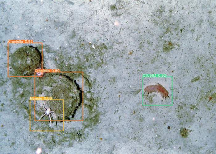
Within the NCCA we have established that deep learning – which is a branch of artificial intelligence – can be used to count marine animals reliably and quickly in the right conditions. This capacity needs to be expanded to a wider selection of species, and pipelines developed that can be applied in-situ, moving us toward a future of AI enabled biological observing.
The NERC funded project ‘Towards net zero: development of AI enabled biological observing’ led by Prof Kerry Howell from the University of Plymouth, is investigating the best methods to translate the large volume of data collected by autonomous systems, into ecological knowledge to then feed into models enabling us to make predictions on how biodiversity is distributed and may change over time. This will drastically improve our perception of the Ocean’s ecology and better inform conservation and management measures.

